Are you planning a trip to Costa Rica and wondering will Google Maps work in Costa Rica? The good news is that it does! However, navigating this beautiful country can be quite different from what you might be used to. In Costa Rica, addresses aren’t based on numbers and street names—instead, people often use landmarks and meters for directions. While Google Maps does work in Costa Rica and can definitely assist you in getting around, there are other navigation apps that might offer even more benefits.
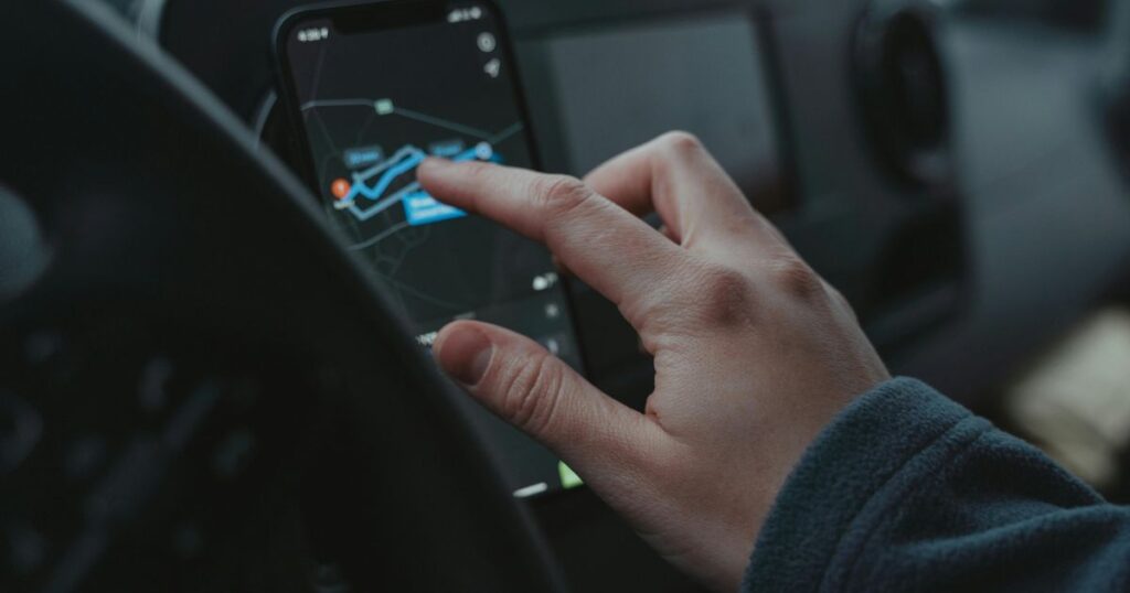
Using a navigation app while traveling is essential for a smooth experience. These apps help you find your way, locate gas stations, and discover restaurants or hotels nearby. With Waze, for example, you can receive real-time updates on traffic and road conditions from other users. This is particularly helpful in Costa Rica, where roads can be unpredictable. Plus, having access to offline maps can save you from data charges and ensure you don’t get lost in remote areas.
In this guide, we’ll explore four essential apps to help you navigate like a local in Costa Rica. Whether you’re looking for driving directions, translation help, or surf reports, these apps have got you covered. Get ready to dive into a world of convenience that will make your travel experience more enjoyable and stress-free in Costa Rica.
Understanding Costa Rica’s Travel Landscape
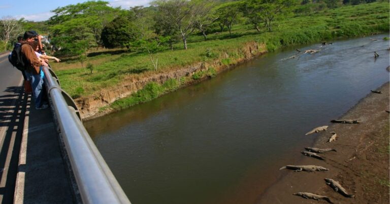
When you travel to Costa Rica, you quickly realize that getting around can be quite different from what you might expect. The country’s landscape is a mix of beautiful mountains, dense jungles, and stunning coastlines. However, this natural beauty also brings some navigational challenges. Many roads are poorly marked, and traditional street signs are often missing. This can make it tough to know where you are or how to get where you want to go.
Let’s explore why navigation apps are a must-have for any traveler exploring Costa Rica below:
Unmarked Roads
One of the biggest issues travelers face is that many roads simply aren’t marked. You won’t see street names like you might at home. Instead, locals often give directions based on landmarks or distances. For example, someone might tell you to turn left at the big tree or go 300 meters past the church. This can be confusing, especially if you’re in a hurry. Navigation apps like Waze or Google Maps can help bridge that gap. They provide a clear visual guide. You can enter your destination and get real-time directions without needing to rely solely on local landmarks.
Hard Terrain
Another factor that affects navigation is Costa Rica’s rugged terrain. The country is home to mountains and hills that can make driving tricky. Some roads are steep and winding, and others are unpaved. If you’re venturing into rural areas or national parks, you might encounter dirt roads that require a sturdy vehicle. Navigation apps can help you choose the safest and most efficient route. They can alert you to any obstacles or road conditions ahead. This way, you can focus more on enjoying the views instead of worrying about your route.
Limited Connectivity
While Costa Rica is known for its natural wonders, cell service isn’t always reliable. In remote areas, you may find yourself without any signal. This can leave you feeling lost and unsure of where to go next. Luckily, both Google Maps and Waze allow you to download maps for offline use. You can save your route before heading out, ensuring you have access to navigation even when you’re off the grid. This feature is especially useful when exploring areas like Manuel Antonio or Monteverde, where connectivity can be spotty.
Navigating Costa Rica can be a unique experience. The poorly marked roads, challenging terrain, and occasional lack of connectivity all add to the adventure. To make your trip smoother, using navigation apps is highly recommended. They provide the guidance you need to explore this beautiful country confidently. So, whether you’re driving to a beach or hiking through a national park, having a reliable navigation tool on your phone will make all the difference.
Will Google Maps Work in Costa Rica? Here’s What You Need to Know
Traveling in a foreign country can be daunting, especially when you’re navigating unfamiliar roads and landscapes. Fortunately, Google Maps has made it easier for travelers to find their way around, and it works remarkably well in Costa Rica. While you may not find traditional street addresses here, Google Maps compensates with comprehensive mapping capabilities, allowing you to explore this beautiful country with confidence. In this guide, we will delve into how Google Maps functions in Costa Rica, its best features, and tips on using it wisely during your travels.

Why Google Maps Works in Costa Rica
Google Maps operates effectively in Costa Rica due to its extensive database of landmarks, tourist attractions, and user-generated content. This app has been enhanced by continuous updates, ensuring that the information provided is accurate and up-to-date. GPS data has improved significantly over the years, meaning that if you’re traveling along popular tourist routes, you can rely on Google Maps for reliable directions. While traditional addresses may be scarce, Google Maps utilizes points of interest—like hotels, restaurants, and natural landmarks—to help guide you to your destination.
Best Features of Google Maps for Traveling in Costa Rica
Here are the best features of Google Maps that make traveling in Costa Rica easier:
- Offline Maps: One of the standout features of Google Maps is its offline capability. Before you embark on your adventures, you can download specific areas of Costa Rica so that you can access maps without an internet connection. This is especially useful in remote areas where signals might be weak or non-existent.
- Point of Interest Search: Google Maps allows you to search for various points of interest (POIs) like gas stations, restaurants, beaches, and attractions. This makes it easy to find amenities or activities nearby, ensuring you’re never far from what you need.
- Real-Time Traffic Updates: With real-time traffic data, Google Maps can provide you with the most efficient routes, helping you avoid congested areas and save time. This is particularly beneficial in urban settings like San José, where traffic can be heavy.
- User Reviews and Photos: Google Maps integrates user-generated content such as reviews and photos, giving you valuable insights into the quality and popularity of various locations. This can help you choose the best places to visit or eat.
- Navigation for Diverse Modes of Transport: Whether you’re walking, cycling, or driving, Google Maps offers tailored navigation options for your mode of transport. This adaptability makes it a valuable tool regardless of how you choose to explore Costa Rica.
How to Use Google Maps Wisely in Costa Rica
To maximize your experience with Google Maps while traveling in Costa Rica, consider the following tips:
Pre-download Offline Maps
Before you begin your journey, make sure to download the Costa Rica maps for offline use. To do this, go to Google Maps, search for the area you want, tap on the name of the place at the bottom, and select “Download.” This will ensure you can navigate without relying on data.
Save Your Locations
Create a “Saved Places” list in Google Maps. As you research your itinerary, mark important locations—like attractions, restaurants, and hotels—so you can easily access them during your trip.
Check for Recent Updates
Sometimes, routes or points of interest may change. It’s a good practice to refresh your Google Maps and check for any recent updates before heading out.
Use GPS Features Wisely
While GPS is generally reliable, always have a backup plan. Bring a physical map or familiarize yourself with the surrounding area, just in case you encounter any technical issues or your phone runs out of battery.
Be Aware of Your Surroundings
While Google Maps is a powerful tool, it’s essential to remain aware of your environment, especially when navigating rural areas or unfamiliar neighborhoods. Trust your instincts, and don’t hesitate to ask locals for directions if needed.
All in all, Google Maps can be an invaluable resource for navigating Costa Rica. With its range of features designed to enhance your travel experience, from offline accessibility to detailed point-of-interest searches, you can explore this stunning country with ease. By using Google Maps wisely, you can ensure a smooth and enjoyable adventure through Costa Rica’s diverse landscapes and vibrant culture.

4 Apps to Navigate Costa Rica Like a Local
Costa Rica’s breathtaking landscapes and vibrant culture are waiting to be explored, but if you’re planning to venture off the beaten path, knowing how to get around is essential. The country’s unique approach to addresses—often relying on landmarks and distances rather than street names—can make navigation a bit tricky for newcomers. Thankfully, modern technology has your back! With the right navigation apps, you can navigate the winding roads and hidden gems of Costa Rica with ease and confidence.
Whether you’re driving through lush rainforests, visiting picturesque beaches, or exploring charming towns, these four essential navigation apps will help you find your way like a local:
1. Waze
Waze is a crowdsourced navigation app that has become an essential tool for travelers in Costa Rica, where traditional street names and addresses are often absent or unreliable. The app offers real-time updates on road conditions, traffic, and hazards, making it particularly useful for navigating the country’s unique landscape, which relies on landmarks for directions. Users can download maps for offline use after connecting to Wi-Fi, which not only conserves data but also ensures accurate navigation even when cell service is limited.
With its user-friendly interface and community-driven updates, Waze significantly enhances the driving experience in Costa Rica, allowing travelers to navigate with confidence and ease.
Best Features of Waze
- Crowdsourced Information
Waze relies on information from its users. This means that any road hazards, traffic jams, or police presence can be reported in real-time. This feature helps you avoid delays and stay safe while driving.
- Offline Capabilities
If you download your route while connected to Wi-Fi, Waze can provide directions even without a mobile data connection. This is particularly useful in areas where internet service is spotty.
- Customizable Routes
You can choose your preferred route based on distance, traffic, or even the type of roads you want to avoid. This flexibility makes it easier to tailor your trip to your personal preferences.
- Voice Navigation
Waze gives you turn-by-turn voice directions. This means you can keep your eyes on the road and your hands on the wheel. The app also makes it easy to adjust settings for voice prompts.
- User-Friendly Interface
Waze has a simple and intuitive design, making it easy for anyone to navigate. Even if you’re not tech-savvy, you can quickly learn how to use it.
How to Use Waze Wisely in Costa Rica
- Download the App Before Your Trip
Make sure to install Waze on your phone before you arrive in Costa Rica. This way, you can familiarize yourself with its features.
- Download Offline Maps
Before you hit the road, connect to Wi-Fi and download your route. This will save your mobile data and ensure you have access to the map if you lose service.
- Enable Location Services
Waze needs access to your phone’s GPS to provide accurate directions. Go into your phone settings and make sure location services are enabled.
- Adjust Settings for Alerts
You can turn on alerts for traffic, police, and road hazards. This will help you stay informed about what’s happening on your route.
- Be Aware of Road Conditions
Costa Rican roads can be tricky. Watch for unpaved paths and sudden changes in road quality. Waze can help, but always stay alert.
- Stay Connected
If possible, consider getting a local SIM card for data. This can help you stay connected and allow Waze to give you real-time updates.
- Use Landmarks for Confirmation
When following Waze, keep an eye out for landmarks mentioned in the app. This can help you confirm you’re on the right track.
Using Waze in Costa Rica can greatly enhance your travel experience. With its many useful features, it helps you navigate the unique roadways with ease. Just remember to use it wisely and stay alert.
2. Maps.me
Maps.me is an excellent navigation app for travelers in Costa Rica, particularly due to its offline capabilities. Unlike traditional GPS applications that require a constant internet connection, Maps.me is a free offline map application that allows users to download detailed maps of Costa Rica beforehand, enabling navigation without data or Wi-Fi. This is especially useful in areas with limited connectivity, as it provides accurate directions, points of interest, and local landmarks, making it easier for travelers to find their way around the country.
With its user-friendly interface and comprehensive mapping, Maps.me stands out as a reliable resource for navigating the unique landscape of Costa Rica, where conventional addresses are often absent.
Best Features of Maps.me
- Offline Maps
Maps.me lets you download maps for offline use. This means you can navigate even without a data connection. It’s perfect for traveling through remote areas.
- User-Friendly Interface
The app is designed to be simple and easy to use. You can easily zoom in and out, search for locations, and find your way around.
- Detailed Points of Interest
Maps.me includes numerous points of interest, such as restaurants, hotels, and tourist attractions. You can discover local hot spots that you might not find in guidebooks.
- Customizable Routes
You can create and save your own routes. This feature is especially helpful for planning day trips or scenic drives across Costa Rica.
- Community Contributions
The app benefits from user feedback and contributions. This ensures that the information is up-to-date and relevant.
How to Use Maps.me Wisely in Costa Rica
- Download the App Before You Go
Make sure to download Maps.me before your trip. This will save you time when you arrive in Costa Rica.
- Download Maps for Specific Areas
Once you have the app, download the maps for Costa Rica. Focus on areas you plan to visit, such as San José, Arenal, or Manuel Antonio.
- Search for Points of Interest
Use the search function to find restaurants, beaches, and attractions. You can easily locate nearby amenities that suit your interests.
- Create Your Route
Before you head out for the day, plan your route using the app. Mark places you want to visit, and Maps.me will help you navigate from one location to another.
- Keep Your Phone Charged
Since you’ll be using your phone for navigation, ensure your battery is charged. Consider carrying a portable charger to avoid running out of power.
- Stay Aware of Your Surroundings
While using Maps.me, always pay attention to your surroundings. This will help you stay safe and enjoy the scenery.
- Explore Off the Beaten Path
Don’t hesitate to venture into less-traveled areas. Maps.me can guide you to hidden gems that are often missed by tourists.
By taking advantage of Maps.me, you can navigate Costa Rica like a local. It provides you with the tools you need to explore this beautiful country confidently and conveniently.

3. iOverlander
iOverlander is an essential app for anyone looking to explore Costa Rica, especially if you’re interested in camping or finding unique outdoor experiences. This app offers a comprehensive database of campsites, points of interest, and user-generated content that helps navigate the often challenging landscape of camping and lodging options in Costa Rica.
Unlike conventional maps, which may lack detailed information about campsites, iOverlander provides real-time updates from fellow travelers, ensuring you have access to the latest information on available facilities and conditions. This makes it an essential tool for adventurers seeking off-the-beaten-path experiences, allowing you to plan your journey with confidence and find hidden gems.
Best Features of iOverlander
- User-Generated Content
The strength of iOverlander lies in its community. Travelers contribute reviews, photos, and tips about various campsites and attractions. This means you get real, firsthand experiences from those who have been there before.
- Detailed Campsite Information
The app provides details about each campsite, including amenities, GPS coordinates, and any fees involved. This information can save you time and help you choose the right place for your trip.
- Offline Access
One of the best features is the ability to access maps and information offline. In remote regions of Costa Rica, where cell service can be spotty, this is invaluable. You can download the necessary maps and access them without an internet connection.
- Filter Options
iOverlander allows you to filter your search based on your preferences. Whether you’re looking for campgrounds, water sources, or rest areas, you can customize your search to find exactly what you need.
- Community Advice
Users often leave tips about local attractions, safety concerns, and best practices for camping in Costa Rica. This collective knowledge can enhance your travel experience and help you avoid potential pitfalls.
How to Use iOverlander Wisely in Costa Rica
- Download the App Before Your Trip
Make sure to download iOverlander and familiarize yourself with its features before you arrive. This will help you understand how to navigate the app effectively while you’re on the go.
- Search for Campsites and Points of Interest
Use the search feature to find campsites and attractions that fit your itinerary. Don’t hesitate to explore the map to discover hidden gems that may not be on traditional tourist routes.
- Check Reviews and Photos
Before heading to a campsite or point of interest, read the latest reviews. Look at photos shared by other users to get a feel for the location. This will help you set realistic expectations.
- Download Offline Maps
Once you’ve identified the areas you’ll be visiting, download the maps for offline use. This ensures you won’t get lost in areas with poor cell service.
- Contribute Back to the Community
After your trip, take a moment to add your own reviews, photos, and tips to iOverlander. This way, you can help fellow travelers just like you.
Using iOverlander can significantly enhance your travel experience in Costa Rica. With its community-driven insights and essential features, you can navigate the country with confidence and discover some amazing spots along the way.
4. Sygic
Sygic is a highly recommended navigation app for travelers in Costa Rica, especially for those venturing into areas with limited internet connectivity. It offers offline maps, which can be downloaded before your trip, allowing you to navigate without relying on mobile data or Wi-Fi. Sygic features detailed maps that include points of interest, road hazards, and route optimization, making it an excellent choice for navigating the country’s unique landscape where traditional addresses are scarce.
With voice-guided navigation and the ability to customize routes based on your preferences, Sygic enables travelers to explore Costa Rica’s diverse regions confidently and efficiently, ensuring a smoother travel experience.
Best Features of Sygic
- Offline Maps
One of the standout features of Sygic is its ability to download maps for offline use. This is crucial in Costa Rica, where internet service may be spotty. You can access maps anytime, even without data.
- Voice Navigation
Sygic provides turn-by-turn voice navigation. This feature is very helpful when driving. You can keep your eyes on the road while the app guides you to your destination.
- Points of Interest
The app includes a comprehensive database of points of interest. This means you can discover gas stations, restaurants, and attractions along your route. It’s like having a local guide in your pocket.
- Real-Time Traffic Updates
Sygic offers real-time traffic updates in select regions, but it may not be as effective or widely available in Costa Rica. While this feature is great for busy areas or during peak travel times, you may not always get reliable traffic data in rural or remote parts of Costa Rica.
- Customizable Routes
You can customize your driving routes with Sygic. It lets you choose between the fastest or most scenic routes. This is perfect for those who want to take in the beautiful landscapes of Costa Rica.
How to Use Sygic Wisely in Costa Rica
- Download Maps Before Your Trip
Before you leave for Costa Rica, download the maps for the areas you plan to explore. This ensures you have access to maps even when you’re offline. It’s a simple step that saves you from potential frustration later.
- Familiarize Yourself with the App
Take some time to explore Sygic at home. Get comfortable with the layout and features. This will make it easier to use when you’re on the road.
- Plan Your Routes in Advance
When possible, plan your routes ahead of time. Enter your destinations in the app, and consider saving them for quick access later. This can help you navigate more smoothly, especially in an unfamiliar area.
- Use Voice Commands
While driving, utilize the voice navigation feature. This allows you to hear directions without taking your attention away from the road. It’s always safer to keep your hands on the wheel and your eyes ahead.
- Adjust Settings for Costa Rica
Explore the app settings and adjust them for your trip. For example, you can set it to avoid toll roads or select your preferred type of route. Customizing your settings can enhance your overall experience.
In summary, Sygic is a fantastic tool for navigating Costa Rica. Its offline maps, voice navigation, and real-time updates make it a user-friendly choice for travelers. By downloading maps before your trip and familiarizing yourself with the app, you can navigate like a local and enjoy all that Costa Rica has to offer.

Safety and Security Tips for Using Navigation Apps
To help you navigate Costa Rica safely and confidently, here are some essential tips for using navigation apps effectively during your travels:
Download Maps Offline
Before hitting the road, it’s advisable to download your route for offline use. Both Waze and Google Maps allow you to save maps, which can be a lifesaver in areas with limited or no mobile data coverage. This will not only save on data usage but also ensure you have access to the map when you need it most.
Use Wi-Fi to Update Routes
When planning your trip, connect to Wi-Fi to download the latest maps and updates. This will help you avoid potential navigation issues caused by outdated information. Additionally, pre-planning your route while connected to a stable internet source will minimize the need for data usage while driving.
Stay Alert to Surroundings
While navigation apps are incredibly useful, they shouldn’t replace your awareness of the environment. Pay attention to local road signs, landmarks, and other drivers, as they can provide valuable context that a navigation app may not. This is especially important in Costa Rica, where directions often rely on physical landmarks rather than street names.
Avoid Using Your Phone While Driving
It’s important to prioritize safety by minimizing distractions. If you need to adjust your navigation app or look for directions, pull over to a safe location before doing so. Using a hands-free device or voice commands can help reduce distractions but should still be approached with caution.
Be Wary of Data Charges
While using navigation apps, keep an eye on your mobile data usage. Some apps can consume a lot of data, especially if you are frequently updated on traffic conditions. Consider purchasing a local SIM card with a data plan that aligns with your needs, or rely on offline maps when possible.
Understand Local Driving Conditions
The roads in Costa Rica can vary greatly in quality, and some areas may be prone to hazards such as potholes or unexpected detours. Familiarize yourself with local driving conditions and utilize your navigation app to check for real-time updates on road hazards shared by other users.
Avoid Driving at Night
Unless you’re comfortable with the local driving conditions, it’s best to avoid driving at night. Poorly lit roads, the absence of street signs, and wildlife crossing can pose serious risks. Navigation apps may not always account for these dangers, so plan to arrive at your destination during daylight hours.
Share Your Location
If traveling with others or even solo, consider sharing your live location with a friend or family member. This can add a layer of security and provide peace of mind in case of unexpected issues.
Know Emergency Numbers
Familiarize yourself with local emergency numbers and the locations of nearby hospitals or police stations. In case of an emergency while navigating, knowing this information can be invaluable.
By following these tips while using navigation apps in Costa Rica, you can enhance your travel experience, reduce stress, and navigate the beautiful terrain with confidence.
Frequently Asked Questions
To help you navigate the beautiful and often tricky roads of Costa Rica, we’ve compiled a list of frequently asked questions about popular navigation apps like Google Maps and Waze. Explore below to learn more.
How do cell signals affect navigation apps like Waze and Google Maps in Costa Rica?
Cell signals can be spotty in some remote areas of Costa Rica, impacting the performance of your navigation app. While both Waze and Google Maps work in urban areas, their effectiveness can diminish in rural locations, particularly on gravel roads. It’s wise to download offline maps or plan your route in advance to mitigate issues caused by weak cell signals.
Can I use a navigation app to find my current location in Costa Rica?
Yes, both Waze and Google Maps can accurately determine your current location using GPS technology on your smartphone. However, it’s important to have a strong cell signal or downloaded maps to ensure that your precise location is updated in real time, especially in less populated areas. Using offline maps can also help if you’re in areas with limited data plans.
What should I do if my navigation app gives me wrong directions?
If you encounter wrong directions while using Waze or Google Maps, consider checking for any available real-time road updates. Both apps can provide alternate navigation plans if a route has changed due to road closures or accidents. If you experience continuous errors, it might be helpful to restart the app or switch to another navigation app, such as Map.Me, which works offline.
Are navigation apps reliable for road trips in Costa Rica?
Yes, both Google Maps and Waze are generally reliable for road trips in Costa Rica, but there are a few caveats. Given that many roads may not have formal names or numbers, using landmarks is often necessary. Be prepared for gravel roads and ensure that your phone app has offline maps downloaded for areas where cell signals may be limited.
What’s the best way to use navigation apps on a day trip adventure in Costa Rica?
For a successful day trip adventure, prepare your navigation plan ready by downloading offline maps before you leave. Both Waze and Google Maps can help you find the fastest route to your destination, but try to save specific locations in advance. This saves time and makes it easier to navigate, especially if cell signals are weak on gravel roads.
Can I use navigation apps without a data plan?
Yes, you can use Google Maps in an offline mode by downloading maps for Costa Rica beforehand. Waze typically requires a live data connection for real-time updates, but you can still use it for navigation if you have preloaded your route. Make sure your smartphone is set up with the necessary maps and locations before heading out, especially if you have a limited data plan.
How do navigation apps handle road accidents and closures in Costa Rica?
Both Waze and Google Maps provide real-time updates on road conditions, which include road accidents and closures. Waze is particularly good at rerouting you to alternate navigation plans based on traffic incidents, while Google Maps may offer slower updates. Always check for these updates before starting your journey to avoid potential delays.
What features should I look for in a navigation app for driving on gravel roads?
When driving on gravel roads in Costa Rica, look for navigation apps that offer offline traffic info and real-time road updates. Waze often excels in providing alternate routes if your initial path leads to unpaved roads. Ensure your smartphone has the app updated and offline maps downloaded to enhance navigation in these areas.
Is it better to use Waze or Google Maps to find the shortest route in Costa Rica?
While both apps can find the shortest route, Waze is often preferred for its ability to consider real-time traffic conditions, effectively optimizing your travel time. Google Maps is excellent for broader planning and offline navigation. Depending on your preferences for ease of use and real-time updates, you may choose one over the other, but both can serve well for navigating Costa Rica.
Final Thoughts
Truly, navigating the beautiful landscapes of Costa Rica has never been easier, thanks to the variety of navigation apps available to travelers. Whether you choose Waze, Google Maps, or even offline options like Map.Me, you can embark on your adventures with confidence. Each app offers unique features suited to different needs, ensuring you can find your way without the stress of traditional navigation methods. With user-generated content and offline maps, these tools empower you to explore Costa Rica’s diverse attractions and hidden gems.
The flexibility of these navigation apps means travelers need not fear the unfamiliarity of the roads or the lack of conventional addresses in this stunning country. Instead, you can enjoy the journey as much as the destination, seamlessly finding your way to breathtaking beaches, lush rainforests, and vibrant towns. The ability to search for gas stations, restaurants, and accommodations right from your phone makes the experience even more convenient, allowing you to focus on soaking in the rich culture and natural beauty that Costa Rica has to offer.
If you’re considering a rental car for your adventures, Budget Costa Rica provides a wide range of options to suit any traveler’s needs. This way, you can comfortably navigate the country’s stunning terrain while utilizing your preferred navigation app. So, gear up for an unforgettable journey and explore Costa Rica with the freedom and convenience of a rental car from Budget Costa Rica.